How to Map Industrial Activities, Exposed Materials, Storm Drains, Drainage Directions, and Discharge Points for Your NJDEP Stormwater Plan
If your New Jersey facility has an industrial stormwater permit, your stormwater pollution prevention plan needs a site map, and that sounds like a ten-minute sketch until you sit down to draw one. The plan is called a SWPPP (pronounced "swip"), though NJDEP calls it an SPPP and you'll also hear it called an SP3 or just the stormwater plan. The map has to show what happens on your property, what's sitting outside in the rain, and exactly where that rain goes when it leaves. Getting that right takes a lot of walking, watching, and checking, and a wrong map can sink an otherwise decent plan.
The short answer is yes, you can draw one yourself, and NJDEP's forms for the basic permit allow it, but the drainage part is hard to get right and inspectors increasingly expect something more polished than a sketch. This guide walks through what to put on the map, how to find your storm drains and discharge points, and the mistakes that get maps flagged. We'll also be straight about where doing it yourself gets risky and when it makes sense to reach out to RMA. If your site is simple, you may be able to handle most of this on your own.
Table of Contents
TL;DR
A New Jersey SWPPP site map shows your property, your industrial activities, anything stored or handled outdoors, every storm drain, the direction water flows, and each place stormwater leaves the site. NJDEP's form for the Basic Industrial Stormwater permit accepts a hand-drawn map if every feature is clearly marked and labeled, and a small, simple site can sometimes manage that. Drainage and discharge points are the hard part, and mistakes there are easy to make. In our experience, inspectors now expect a clean, professional-looking map, which usually means mapping or drawing software, so many facilities draft the map themselves and have a professional finish it.
What Is a SWPPP Site Map and Why Does New Jersey Require One?
In New Jersey, stormwater at industrial sites is regulated under NJPDES, the New Jersey Pollutant Discharge Elimination System, which NJDEP runs. Most facilities get coverage through a general permit, a ready-made permit NJDEP issues for a type of operation, like the Basic Industrial Stormwater permit (5G2) or the industry permits for scrap metal, concrete products, and others. Each one expects a written plan, and the site map is the part of that plan that shows an inspector, in one glance, what your written descriptions mean on the ground. If you're not sure which permit you're under, our guide to which NPDES permit you need sorts it out.
NJDEP's plan form for the Basic Industrial permit asks for a map of your site, preferably drawn to scale. It says to use existing engineered drawings if you have them, and it says hand-drawn maps are acceptable if all features are clearly indicated and labeled. The other industrial permits have their own plan requirements, and what each one wants on the map can differ, so read the plan section of your own permit before you start. For a broader look at the plan itself, see what a SWPPP is and what goes in it.
What Should a New Jersey SWPPP Site Map Show?
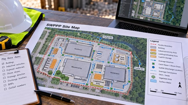
Think of the map as an answer key for four questions: what do we do here, what's exposed to rain, where does the water go, and where does it leave. This table covers the features to include, and the permit you're under may ask for more.
| Feature |
What to Mark |
Where People Miss It |
| Property and buildings |
Property lines, every building, and paved versus unpaved ground |
Leased areas and storage on neighboring lots |
| Industrial activities |
Fueling, washing, cutting, crushing, loading, repair, processing, and anything else you do outdoors |
Seasonal or occasional jobs |
| Exposed materials |
Stockpiles, drums, tanks, scrap bins, dumpsters, pallets, and parked equipment |
Small items like a single drum rack or a parts bin |
| Covered and indoor areas |
Anything under a roof or inside a building, labeled as such |
Overhangs that don't keep rain off in a windy storm |
| Storm drains |
Every catch basin, inlet, grate, and trench drain, numbered |
Drains in a neighbor's lot that receive your runoff |
| Drainage direction |
Arrows showing which way water flows across each surface |
Flat-looking paving that actually slopes |
| Discharge locations |
Each point where water leaves the site, with the area that drains to it |
Water that runs off an edge or soaks in rather than leaving through a pipe |
| Nearby water features |
Streams, ditches, ponds, wetlands, basins, and the storm sewer you connect to |
Ditches along the road that carry your water |
| Controls and non-stormwater drains |
Berms, covers, sumps, filters, and any floor drain or wash water outlet |
Controls that exist in the plan but not on the map |
| Legend, north arrow, scale, date |
A key to every symbol, plus orientation, scale, and the date of the last update |
No date, so nobody knows how current it is |
Two of those rows carry most of the weight. Inspectors compare your exposed materials and your discharge points against what they see standing in your yard, and those are the places a missing or misplaced symbol shows up fastest. A drain that's on the ground but not on your map tells an inspector the plan was written without a real walk of the site.
How Do You Build a SWPPP Site Map Step by Step?
Start with the best base map you can get. If an engineer drew a site plan when the facility was built or expanded, use it, since NJDEP's form points to existing engineered drawings. If you don't have one, a current aerial photo printed at a readable size works as a starting point. Either way, check it against the ground. Buildings get added, paving gets patched, and a plan from ten years ago often shows a yard that no longer exists. We don't do engineering or surveying, so if you need a new engineered drawing, that's a job for an engineering or surveying firm.
Next, walk the site with a printout, a pen, and your phone. Bring someone who works there every day, because they know which corner of the yard gets used for what on a busy week. Mark each industrial activity first, then each exposed material and storage area. Take photos of everything and note which photo goes with which spot. Include things that come and go with the season or the job, and label what's under a roof versus out in the weather.
Then find your drains. Mark every catch basin, inlet, grate, and trench drain you can see, and number them so they can be matched to the written plan. Don't climb into structures or pull heavy covers by yourself. If you can't tell where a drain goes, note it and move on, and the next section covers how to run it down.
Finish by drawing the final version. Add a legend, a north arrow, a scale, and the date, label every feature in plain words, and number your discharge points so the map and the written plan use the same names. Print it on paper large enough to read and check it with the same person who walked the site. If they spot something missing, you want to learn that now rather than on the day an inspector shows up.
How Do You Map Drainage Direction, Storm Drains, and Discharge Locations?
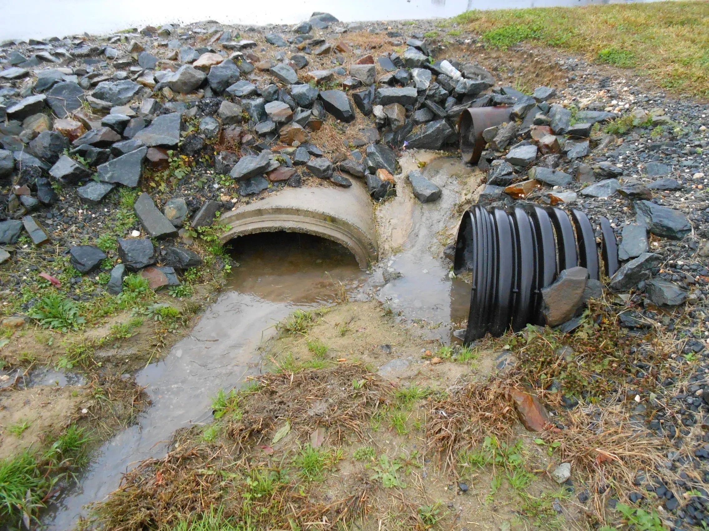
This is the hard part of the map, and it's where most do-it-yourself attempts go wrong. Drainage direction, meaning which way water flows across each surface, is easy to guess and hard to confirm. Paved yards look flat and usually aren't. A grade change of a few inches can send water to a different drain or off the property entirely. The best test is a rainy day. Stand in the yard during a real storm, watch where the water moves and where it collects, and draw the arrows from what you see rather than from what the plan says.
Next, follow each drain to where it ends up. A drain can lead to a pipe that discharges to a stream or ditch, to a detention or infiltration basin, to the ground, to your town's storm sewer system, or to a sewer that carries wastewater. NJPDES covers discharges to groundwater as well as to surface water, so water that soaks into the ground at your site belongs on the map too. Where the water ends up also changes which rules apply. If your site drains to a sewerage authority's system, that authority's requirements may apply instead of, or alongside, an NJDEP stormwater permit, so confirm where your site connects before you rely on an assumption. Engineered drawings, utility plans, and your town's storm sewer map, where one exists, can help you trace pipes you can't see.
Mark each discharge location, the point where stormwater leaves your site, and outline the area of the site that drains to it. Include sheet flow too, where water runs off the edge of a lot without going through a pipe, since it still leaves your property. Show where water that isn't stormwater goes, like floor drains and wash water, and keep it visibly separate. Our post on the difference between stormwater and process water explains why that line matters.
If you can't confirm where a drain goes, don't guess. An arrow drawn on a hunch becomes a statement about your facility, and someone at your company stands behind the plan. A note saying a drain still needs to be traced is a better map than a confident wrong one. Trace it, then fix the map.
What Mistakes Make a SWPPP Site Map Fail an Inspection?
Most map problems are variations on the same few things. The first is age. The map was drawn when the plan was written and never touched again, while equipment moved, a new building went up, and the stockpile migrated to the other side of the lot. NJDEP's plan forms include a line for the date of the most recent update, and an inspector will compare the map to the yard in front of them. If your team moves materials around, they need to know that a change to the yard is a change to the map. Training the people who move things helps, and our online environmental training library is one place to start.
The second is a map that doesn't match the written plan. The text describes four discharge points and the map shows three, or the stormwater best management practices (BMPs) in the plan, the covers, berms, sumps, and other controls that keep pollutants out of runoff, don't appear on the map at all. The third is a map nobody can read: a faded photocopy, tiny handwriting, symbols stacked on top of each other, no legend. NJDEP accepts hand-drawn maps only if every feature is clearly indicated and labeled, and a map that can't be read doesn't meet that. The fourth is a borrowed map, copied from a template or a similar facility and never checked against your own yard. Our article on common NPDES permit problems covers other places plans fall short.
Is a Hand-Drawn SWPPP Site Map Good Enough, or Do You Need Mapping Software?
For a small, simple site, with one building, one lot, a handful of outdoor materials, and a couple of drains, a careful map marked up on an engineered plan or a clean aerial print can meet what NJDEP's basic permit form describes. If that's you, you don't need us to draw it, and our guide on whether you can write your own SWPPP covers the rest of the plan.
For anything bigger, it's complicated, technical, and a little risky to do alone. Several drainage areas, a mix of paved and unpaved ground, buried pipes, and a neighbor's property next door all raise the odds of a missing drain or a wrong arrow. The permit itself doesn't say you need design software. Still, in our experience, inspectors have started to expect a clean, professional-looking map, and when a map is judged insufficient, a hand sketch is usually the reason.
Most professionals build the map in mapping software, a GIS program, or a design tool like Adobe Illustrator. They lay symbols and labels over an aerial photo or engineered drawing, use a color-coded legend, number every drainage area and discharge point, and fit it all on a page that stays readable when printed. The other advantage is updating. Changing one layer in a file takes minutes, while redrawing a hand-marked map every time the yard changes is a chore people skip.
A middle path works well for many facilities. Do the site walk and the first draft yourself, since you know the yard best, then have a professional check the drainage and produce the final version. That often keeps the cost down because the professional starts with real field notes. What it costs depends on site size, the number of drainage areas, the quality of your base map, and whether a plan already exists. The NPDES pricing calculator below gives you a realistic estimate for RMA's help with a stormwater plan.
How Can RMA Help With Your New Jersey SWPPP Site Map?
RMA is a family-run firm based in New Jersey, and we've been doing environmental compliance work since 1992. We build SWPPPs for New Jersey facilities, site maps included, and our senior staff do the work themselves. If you've drawn a draft, we can look it over and tell you plainly whether it will hold up, or you can ask us to build the whole thing. We don't do engineering design or surveying, and if your site is simple, you may not need us at all. If you'd like to talk it through, you can call, email, or fill out the form on our website, with no pressure and no obligation. Feel free to contact RMA about your SWPPP site map whenever you're ready.