Combine Aerial Imagery, Site Drawings, and Field Observations to Map Drainage, Outfalls, Activities, and Pollutant Sources for PAG-03
If your facility needs Pennsylvania's industrial stormwater permit, known as PAG-03, DEP expects a written Preparedness, Prevention, and Contingency Plan (a PPC Plan) built around your site, and that plan has to include a site map. Plenty of facilities have a survey from when the building went up and an aerial photo on someone's phone, but nothing that shows where stormwater goes or what it touches on the way. So the question we hear a lot is whether you can put the map together yourself.
You can, and this article walks through how: what the permit says the map has to show, how to use aerial imagery, old drawings, and a walk of your property together, and how to turn it all into one document. We'll also cover where the do-it-yourself route gets hard, and if you'd rather hand the job off, you can reach out to RMA at any point.
Table of Contents
TL;DR
Yes, you can build your own PPC Plan site map. Draft it from a current aerial image, check it against any old site or utility drawings, then walk the property in dry weather and during a real rain to confirm where water leaves your site. Show your outfalls, drainage areas, receiving waters, controls, sampling points, non-stormwater discharge spots, and the activities that could pollute runoff, and keep outfall numbers identical everywhere you list them. The harder your piping and drainage are to trace, the more it pays to get help.
What Is a PPC Plan Site Map and Why Does PAG-03 Require One?
PAG-03 is the general permit Pennsylvania DEP uses for stormwater that runs off industrial sites. Facilities that need coverage file a Notice of Intent (NOI), the application form that lists your outfalls, activities, and supporting documents. Part C of the permit then requires you to develop and carry out a PPC Plan under 25 Pa. Code Section 91.34, following DEP's guidelines (document 400-2200-001) and its NPDES-specific addendum. Our comparison of SWPPPs and PPC Plans for PAG-03 covers how that plan differs from the ones used in other states.
The site map is the part of the plan that shows how water moves across your property. A few terms come up constantly. An outfall is a discrete spot where stormwater leaves your site, such as a pipe end, a ditch, or a channel. A drainage area is the ground whose runoff ends up at a particular outfall. A receiving water is the stream, river, lake, or storm sewer the runoff reaches next. PAG-03 only authorizes discharges through the outfalls identified in your NOI, and it isn't available for stormwater discharged directly to High Quality or Exceptional Value waters, so the map has to get both right.
Not every industrial facility ends up in PAG-03. If all your industrial materials and activities are sheltered from rain and snow, you may qualify for a No Exposure Certification instead, which we explain in our article on what No Exposure means.
What Does DEP Expect to See on a PPC Plan Site Map?
The permit is specific about the contents. Part C, Section IV.A.7 says the PPC Plan must include a site map that shows structures, impervious surfaces, control measures, receiving waters, stormwater conveyances, monitoring points, and non-stormwater discharge sites. In plain terms:
| What the Permit Lists |
What It Means on Your Site |
| Structures |
Buildings, sheds, covered storage, fuel islands, silos |
| Impervious surfaces |
Pavement, concrete pads, rooftops, and other hard surfaces that shed water |
| Control measures |
Berms, covers, inlet inserts, oil/water separators, basins |
| Stormwater conveyances |
Inlets, pipes, swales, ditches, and channels that carry runoff |
| Receiving waters |
The stream, river, lake, or storm sewer your runoff reaches |
| Monitoring points |
The outfalls where you collect samples |
| Non-stormwater discharge sites |
Places where something other than rain runoff leaves, such as pavement wash water or air conditioner condensate |
The map doesn't stand alone. The same section requires the plan to identify every potential pollutant source that could affect your stormwater and to flag areas with a high potential for soil erosion. Your NOI also asks for a site plan and a topographic map, and those need to agree with the PPC Plan map. DEP's PPC guidelines add detail beyond the permit's list, so download the current version and read it before you finalize anything.
What Do You Need Before You Start Mapping Your Site?
Gather your raw material first. Pull together any site plans, surveys, and stormwater or utility drawings from construction or later expansions, your current NOI or permit if you're renewing, a list of what's stored and done outdoors, and a rough history of spills or leaks. Ask the people who've been on site longest, because the maintenance supervisor often knows which pipe goes where better than any drawing does.
Most of the tools are free. The Pennsylvania Spatial Data Access portal (PASDA) offers public aerial imagery and GIS data, and DEP's eMapPA shows streams with their Chapter 93 uses and impairment status, which helps you identify your receiving water. Your county likely has a GIS viewer too. For the walk itself, bring a printed aerial or site plan you can mark up, a clipboard, a camera, and a phone with GPS.
How Do You Use Aerial Imagery to Start Your Site Map?
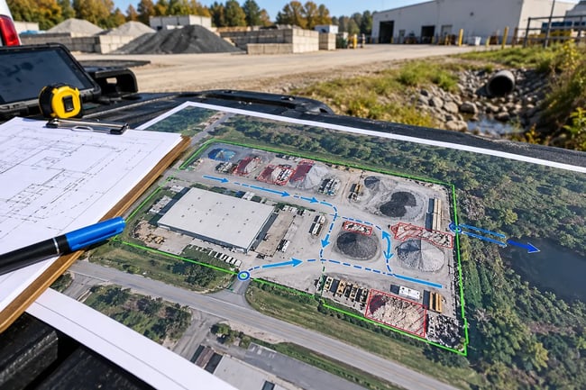
Aerial imagery gives you the base layer and a first guess at the drainage. Open the most recent image at a scale where you can see individual buildings and pavement edges. Trace the property boundary, then outline structures, paved and gravel areas, stockpiles, tanks, dumpsters, bare soil, and any ponds or basins. Shading the hard surfaces makes it easier to judge how much runoff each part of the site produces.
Then read the ground for water. Low spots, staining, grass lines, swales, culvert ends, and basin outlets are often visible from above. If you pull up a topographic map (USGS maps work well), runoff runs downhill at right angles to the contour lines, so you can sketch likely flow arrows and mark where they leave your property. Label those spots as suspected outfalls, and treat them as questions for the field.
What Aerial Imagery Can't Tell You
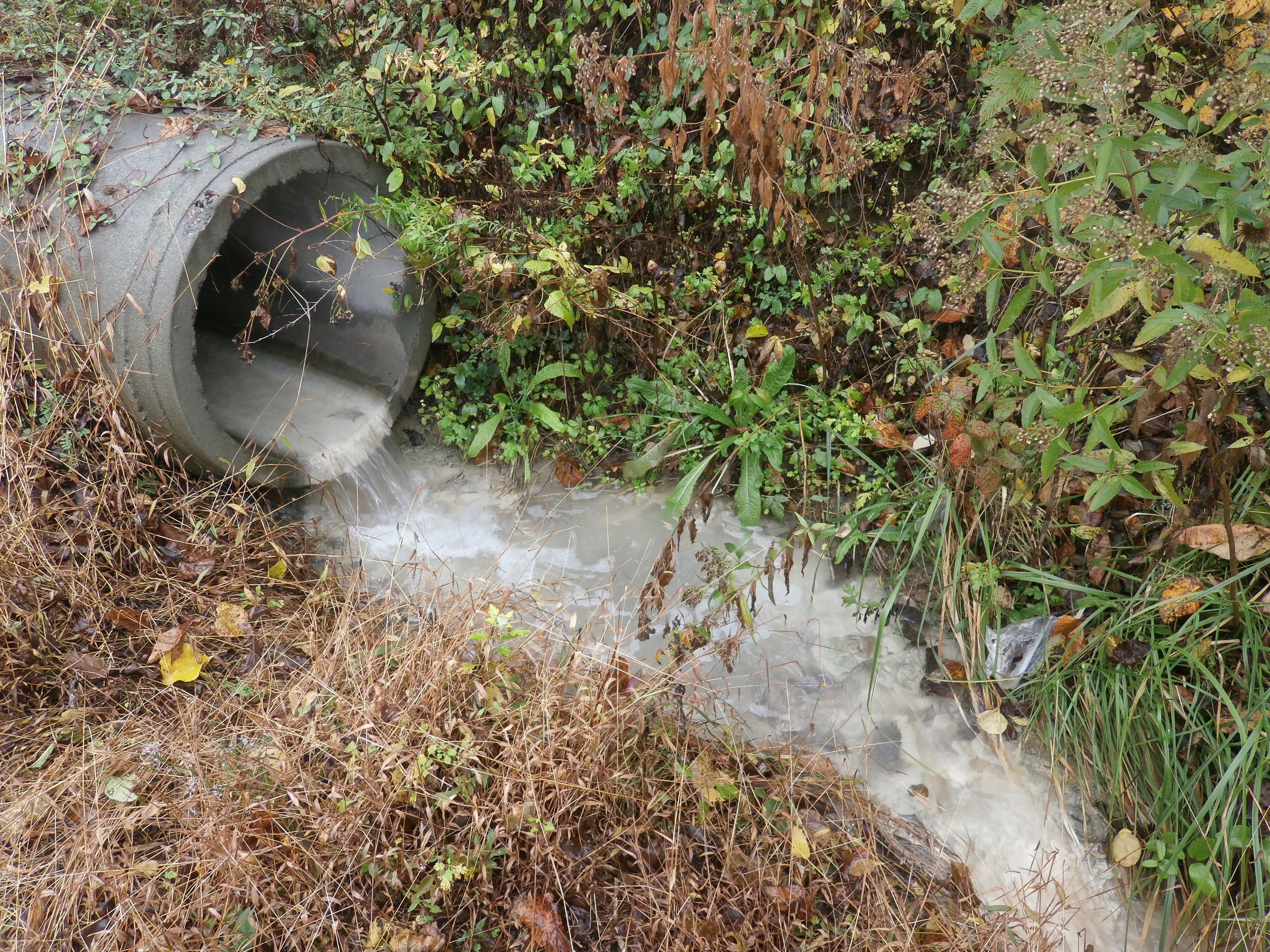
Imagery may be a year or three out of date, trees and shadows hide inlets, and underground piping doesn't show at all. A catch basin in the middle of the lot tells you water goes in, not where it comes out. Write the image date on your working copy, and expect a few guesses to change once you're standing on the site.
How Do Existing Site Drawings Help You Map Stormwater Drainage?
Drawings fill in what imagery can't see. Original site plans, as-built surveys, and utility and stormwater drawings often show inlets, manholes, underground pipes, basins, and the direction water was designed to flow. If your facility was built under a land development approval, the stormwater plans filed with the township are a good place to look, and the township or county office may have a copy if you don't.
Use them to answer the questions the aerial raised. Does that inlet connect to the street's storm sewer, to a basin out back, or to a pipe under the neighbor's lot? Which lines are sanitary and which are storm? Where do the shop floor drains go? The permit's housekeeping measures call for eliminating floor drain connections to storm sewers, and it's better to find one on paper than in a sample result.
Treat drawings as a record of the design, not of the site today. Lots get expanded, pipes get rerouted, and a basin that once drained may now hold water. Mark everything you take from a drawing as "to verify" until you've seen it yourself.
How Do You Confirm Outfalls and Drainage Areas on a Field Walk?
The field walk turns your draft into a real map, and two visits work best. A dry-weather walk lets you trace pipes and look for staining, odors, flowing water, or hoses that point to a non-stormwater discharge. A wet-weather walk during an actual rain shows where the water goes, which is the one thing a drawing can't prove. The permit also requires every outfall to stay accessible for inspections and sampling, so note which ones are hard to reach.
Work through the site one drainage area at a time. Give each confirmed outfall a number (001, 002, and so on), photograph it, note its condition, and record its location, since your phone's GPS gives you coordinates. Draw the boundary of the ground that drains to it and note the receiving water. Mark where runoff from neighbors or the road flows onto your site as well, because that off-site water can change what shows up in a sample.
A few situations call for care. Water that sheets off pavement and across the property line, instead of leaving through a pipe or ditch, is a gray area for how you list it, so ask DEP or a consultant before guessing. If your runoff enters a municipal storm sewer, map the inlet where it leaves your property. If it goes to a combined sewer, which carries stormwater and sewage together to a treatment plant, the sewer authority may control that water and the permit path may differ, so confirm what applies to you. And stay safe: watch traffic, and don't open manholes or enter confined spaces.
How Do You Map Industrial Activities and Pollutant Sources?
With the drainage settled, add what could pollute it. Walk each drainage area and mark every spot where materials, equipment, or work can contact rain: outdoor storage of raw materials, products, and wastes, loading and unloading, fueling, vehicle and equipment maintenance or washing, dumpsters, tanks and drums, stockpiles, and process areas. Mark past spills or leaks too, along with bare or steep ground where soil could wash away.
| Area or Activity |
What It Can Put in Runoff |
| Fueling and vehicle maintenance |
Oil, grease, fuel, coolant |
| Outdoor stockpiles and bulk materials |
Sediment, metals, dust |
| Cement, concrete, or slurry handling |
High pH, solids |
| Dumpsters and waste containers |
Liquids, trash, floatable debris |
| Tanks, drums, and chemical storage |
Product from leaks or overfills |
Be thorough, because what you mark has consequences beyond the drawing. The permit requires you to inspect, at least twice a year, the areas your PPC Plan identifies as potential pollutant sources, plus any area where a leak or spill happened in the past three years. Every source on the map becomes a stop on your inspection route, and anything left off can go uninspected. Draw the controls you already use beside each source, such as the berm around the fueling pad or the separator on the shop drain, since a source next to its control makes gaps obvious. Our guides to stormwater BMPs and doing a stormwater visual inspection pick up from here.
How Do You Combine Everything Into One PPC Plan Site Map?
Merge the layers into one readable document. Start from a clean base, whether an aerial image, a scaled drawing, or a CAD file, and add one layer at a time: boundary, structures, hard surfaces, conveyances, numbered outfalls, drainage area boundaries with flow arrows, receiving waters, controls, monitoring points, non-stormwater discharge spots, and your mapped activities and pollutant sources. Add a legend so a reader who has never visited can follow it, plus a north arrow, approximate scale, facility name, and date. If one sheet gets crowded, split it into an overall map and detail sheets for the busy areas.
The permit sets out what the map must show and doesn't prescribe a drawing format or software. A hand-marked aerial can work if it's complete and legible, and free GIS programs or ordinary presentation software handle the job for many facilities.
Your documents also have to agree with each other. Use the same outfall numbers, drainage area descriptions, and receiving water names on the map, in the PPC Plan text, on the NOI, and in your sampling records. A NOI that lists four outfalls while the map shows three should expect questions from DEP. Keep the current version on site, since the permit requires you to make it available on request.
What Mistakes Cause PPC Plan Site Maps to Get Questioned?
| Mistake |
What Goes Wrong |
Fix |
| Mapping from the aerial alone |
Guessed flow paths and hidden pipes become "fact" |
Verify on a wet-weather walk |
| Copying an old drawing |
The map shows a design the site no longer matches |
Check each feature against current conditions |
| Skipping outfalls that drain clean areas |
The permit recognizes No Exposure Outfalls, so unlisted discharge points leave gaps |
Map every outfall |
| Numbers that differ between documents |
The NOI, map, and plan describe different sites |
Keep one outfall list and reuse it |
| No non-stormwater discharge spots or legend |
A required element is missing, or the reader can't follow the map |
Walk the site dry, and add a legend and date |
When an inspector does show up, the map is one of the first things they'll ask to see, so it helps to know what happens during a PA DEP stormwater inspection before one gets scheduled.
When Do You Need to Update Your PPC Plan Site Map?
The map is only right while the site matches it. PAG-03 requires you to review the PPC Plan at least once a year and update it when the permit changes, when the plan fails in an emergency, when operations change in a way that materially raises the chance of a release, or when DEP asks. Some changes involve DEP directly. You submit an NOI to amend coverage when a new outfall is identified or proposed, and you notify DEP for a determination when you add impervious surface in an outfall's drainage area, store new bulk materials or wastes where rain can reach them, or alter the site so off-site water flows onto it.
If you're building or expanding, construction brings its own requirements, including erosion and sediment control plans, construction stormwater coverage, and local land development approvals under Chapter 102 and municipal rules. RMA doesn't prepare construction-phase permits or approvals, so you'd work with your engineer, contractor, or an erosion and sediment control specialist on that piece. What we can do is help you figure out what the construction phase triggers and point you toward the right people, then help you update your PPC Plan, map, and permit coverage so the finished facility is covered once it's running.
Should You Map It Yourself or Get Help With Your PPC Plan Site Map?
For a small site with one building, an obvious drainage pattern, and one or two clear outfalls, mapping it yourself is realistic, and we'd tell you so. It gets harder with several drainage areas, underground piping you can't trace, infrastructure shared with neighbors, discharges near sensitive streams, or no usable drawings. Errors on the map flow into the NOI and the sampling plan, so the harder the site, the more a second set of experienced eyes pays off. Our article on getting a PAG-03 permit yourself covers the full do-it-yourself picture, and our guide to choosing a PAG-03 consultant helps if you decide to hire out.
The cost of professional help depends on the number of outfalls and drainage areas, the size of the site, the quality of your existing drawings, whether a PPC Plan already exists, and whether sampling needs setting up. We break down the numbers in how much a PAG-03 permit costs in Pennsylvania, and the pricing calculator below gives you a quick estimate for RMA's help with your facility, with no email, sales call, or obligation.
How Can RMA Help With Your Pennsylvania PPC Plan Site Map?
We work with Pennsylvania facilities all the time, and there's more than one way we can help with a site map. Some people draft their own and ask us to review it before it goes to DEP. Others want us to trace the drainage and build the map and PPC Plan from scratch. If you're still sorting out whether PAG-03, an individual permit, or No Exposure fits, our Pennsylvania NPDES and stormwater services page explains each path.
There's no pressure and no obligation. You can call us, send an email, or fill out the form on our website, and we'll tell you whether you need us at all. To get started, reach out to our team and tell us a little about your site.